OS1/20/68/10


| List of names as written | Various modes of spelling | Authorities for spelling | Situation | Description remarks |
|---|---|---|---|---|
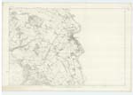
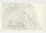
| RIVER NITH | River Nith Nith River River Nith River Nith River Nith River Nith River Nith River Nith |
Map of County attached to Stat. Acct. [Statistical Account] Ainslie's Map - 1820 Sinclair's Stat.Acct. vol [Statistical Account volume] 1 Page 115 Stat. Acct. of Kirkcudt. [Statistical Account of Kirkcudbright] 1845 Simpson's Description of Galloway - 1684 Grose's Ant. vol. [Antiquities Volume] 2 Page 171 Mr Welsh Provost Maxwelltown Mr McGowan Archt [Architect] |
027; 034 | [Situation] Running Southerly & passing the E, [East] side of Maxwelltown &. thence to its conflux with Solway Frith A. considerable river which [rises in] the SW. [South West] end of the Parish of [New] Cumnock in Ayrshire and [running through] the western portion of [Dumfriesshire] after receiving the River Cluden [East of] Lincluden College It then becomes [the] boundary between the counties of Kirkcudbright and Dumfries. It [becomes] considerably enlarged by the above then passing the town of [Dumfries] at length falls into the Solway [Firth]. The tide Swells the river at high [water] as far northward as Dumfries. In dry weather during a long extent of its [course] it is quite Small but when rain [falls] owing to the mountainous nature of the [Country] through which it runs It Suddenly Swells [to] a great extent inundating the grounds along [its] banks. It is navigable as far as Dumfries [where] vessels of from 30 to 80 tons burden come up to [the Port] Chiefly importing Coal & lime from Cumberland & exporting provisions to Liverpool etc, |
Continued entries/extra info
[page] 10Parish of Terregles
Form 136 Page
119 River Nith
Transcribers who have contributed to this page.
Chr1smac -Moderator, Moira L- Moderator, Singlie
Location information for this page.