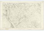
OS1/20/57/11


| List of names as written | Various modes of spelling | Authorities for spelling | Situation | Description remarks |
|---|---|---|---|---|
| LOCH KEN | Loch Ken Loch Ken Loch Ken Loch Ken Loch Ken |
John McCulloch s. n James Gaulds William Candlish Esqr. John Muir s. n. Ph [Parish] Teacher Kells Ainslies Map 1820 |
024 | [Situation] At the S E. [South East] Side of the Parish of KellS. - An expansion of the Water of Ken immediately above the point of the River Dee. It is about 5 miles long & from 1/2 to 3/4 of a mile in breadth, On its West a range of hills Comes down from the interior[,] terminates abruptly at its Southern Corner in a large rocKy Hill Called Benman, "Loch Ken", When approached from the South by a Road leading from KirKcudbright along its left banK into the interior of the GlenKens, presents delightful scenery to the View Some Islets wholly or partially Covered with wood are SprinKled on its Surface Its Shores are in portions tufted with plantations, and at its head Stands Kenmure Castle in a Most picturesque Situation, and the Small burgh of New Galloway. Embowered in a Wood, and finely Seated appears the Ruins of Shermi's house. The LaKe abounds with PiKe Salmon. Trout Perch & Eel &c [etc] - It is the property of the heirs of the late Lord Kenmure This Loch begins to expand at Kenmure Castle & Continues on to the B[e]at of Rhone Near to the Confluence of the BlacK Water of Dee |
Continued entries/extra info
Parish of Kells -- [Page] 11Loch Ken
Transcribers who have contributed to this page.
Molly Miller
Location information for this page.
Linked mapsheets.