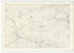
OS1/20/54/3
| List of names as written | Various modes of spelling | Authorities for spelling | Situation | Description remarks |
|---|---|---|---|---|
| BLACK CRAIG or CAIRNSMORE OF DEE | BlacK Craig BlacK Craig BlacK Craig BlacK Craig BlacK Craig BlacK Craig BlacK Craig |
John Muir Ph [Parish] School Master Kells William Candlish BanKer New Galloway William Candlish Provost New Galloway Revd [Reverend] James Maitland Kells Manse Robert KirK William Thomson Ainslie's Map - 1820 |
023 | [Situation] about 1 Mile West of BenbracK. and at the N. [North] West Corner of Plan A Considerable Mountain, or Range On the farms of Laggan of Dee &. Gate the Surface of which is wholly Granite partially Covered with heath. It Summit Commands an extensive View of the Adjacent Country. The Isle of Man, &. A part of England. On it is a Trigl. [Trigonometrical] Station Called by Trigl[?] [Trigonometrical] Party "Cairnsmuir on Dee". . This mountain is also Known by BlacK Craig . - a portion of this [Hill?] is called CurlucKie. |
| RIG OF CRAIG GILBERT | Rig of Craig Gilbert Rig of Craig Gilbert Rig of Craig Gilbert Craig Gilbert |
William Folds James McMichael Robert KirK Ainslies Map 1820 |
023 | [Situation] about 1/2 Mile South of CairnSmorE or BlacK Craig of Dee. A hill of a ridge liKe shape on the farm of Laggan of Dee the Surface of which is rocKy heathy pasture. - Situate close to the North Side of Craig Gilbert. hence the name. This is a Ridge Running South from "BlacK Craig to within a short Distance of The Black Water of Dee. &. part of the Same range. |
Continued entries/extra info
Parish of Kells [Page] 3 1st page of Trace[?]Form 136 Page
30 - Black Craig
29 - Rig of Craig Gilbert
Transcriber's notes
In the Descriptive Remarks of the Black Craig entry "it" in front of Summit is probably meant to be its.Transcribers who have contributed to this page.
Molly Miller
Location information for this page.
Linked mapsheets.


