OS1/20/45/29


| List of names as written | Various modes of spelling | Authorities for spelling | Situation | Description remarks |
|---|---|---|---|---|
| CRAIGMURCHIE | Craig Murchie Craigmurchie Craigmurchie |
Thomas McQuhae John Henderson James McGarva |
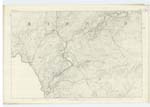
021 | [Situation] About 1 1/4 miles ESE [East South East] of Brigton. A tolerable sized hill on the farm of Larg, its surface consists of rocky heathy pasture. On its summit is a Trigl [Trignometrical] station called by Trigl [Trignometrical] Party Craig Murphy Ints. |
| LARG FELL | Larg Fell Larg Fell Larg Fell |
Thomas McQuhae John Henderson Ainslies Map 1820 |
021 | [Situation] About 1 3/8 miles E. [East] of Brigton. A tolerable sized hill on the farm of Larg, its summit consists of rocky heathy pasture On its summit is a Trigl. [Trignometrical] Station called by Trig [Trignometrical] Party "Craigmurphy North". |
Continued entries/extra info
5Parish of Minnigaff -- [Page] 29
[...]
Page 65 - Craig Murchie
[...] - Larg Fell
[Note] See Name List for Plan 28A.
Craig A rock
Murchie. A man's name or family name
[Note] Larg from the Gaelic Leirg. A plain or from Lairig. A moor, a hill, a sloping hill.
Transcriber's notes
Words are missing in fold on left hand side.Transcribers who have contributed to this page.
raschdorff
Location information for this page.
Linked mapsheets.