OS1/20/45/28


| List of names as written | Various modes of spelling | Authorities for spelling | Situation | Description remarks |
|---|---|---|---|---|
| LAGBAES or BALLOCHARUSH BURN | Mines Burn Mines Burn Lagbae Burn Lagbae Burn Ballocharush Burn Ballocharush Burn |
Thomas McQuhae John Henderson John McMillan A. McMillan John Ferguson William Wilson |
021 | [Situation] Running in a S. [South] Westerly direction through Laggairy Howe. A small stream or burn taking its rise on Larg Fell and running in S. [South] Westerly direction to [...] influx with the Loch [...] Cree. It has its name from several Lead mines having at one time been [...] adjacently. |
| LAGGAIRY HOWE | Laggairryhowe Laggairy Howe |
Thomas McQuhae John Henderson |
021 | [Situation] About 1 1/2 miles ES.E. [East South East] of Brigton. A hollow portion of land situated between Larg Fell and Craig Murchie, and on the farm of Larg. |
Continued entries/extra info
[Page] 28 -- Parish of MinigaffForm 136
Page 66 - Mines Burn
Page 67 - Laggairryhowe
[Note] Lag beath A hollow abounding with birches
[Note] Bealach an ros. The passage or gap of the narrow neck of land
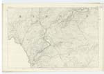
[Note] Lagbaes or Ballocharush Burn - see adjoining Plan 28A
[Note] Lag gariudh. The hollow of the den or cave
Howe A hollow (a pleonasm)
Transcriber's notes
Words are missing in fold on right hand side.Transcribers who have contributed to this page.
raschdorff
Location information for this page.
Linked mapsheets.