OS1/20/41/40


| List of names as written | Various modes of spelling | Authorities for spelling | Situation | Description remarks |
|---|---|---|---|---|
| GLAISTERS HILL | Glaisters Hill Glaisters Hill Glaisters Hill |
James Chesney J. Muirhead Ainslies Map. 1820 |
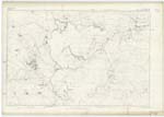
017 | [Situation] About 2 Miles S. [South] by East of Loch Urr A considerable hill on the farm of Upper & Nether Glaisters its Surface consists of heathy pasture. On it is a Trigl. [Trigonometrical] station called by Trigl. [Trigonometrical] Party "Gloster Hill". |
| GLAISTERS BURN | Glaisters Burn Glaisters Burn |
James Chesney J. Muirhead |
017 | [Situation] Running Westerly & forming the Northern boundary of the parish to its conflux with Urr Water about 1 3/8 Miles South of Loch Urr A Small stream or burn having its rise on the farm of Blackmark and running in a Westerly direction, and forming a boundary line between the parishes of Dunscore and Kirkpatrick Durham, its conflux with "Urr Water". |
Continued entries/extra info
[Page] 40Parish of Kirkpatrick Durham
Form 136 Page
74 Glaisters Hill
74 Glaisters Burn
Transcribers who have contributed to this page.
Chr1smac -Moderator, CorrieBuidhe- Moderator
Location information for this page.