OS1/20/35/3


| List of names as written | Various modes of spelling | Authorities for spelling | Situation | Description remarks |
|---|---|---|---|---|
| RIG OF CLENRIE | Rig of Clenrie Rig of Clenrie Clendrie |
William Folds John Murray Ainslies Map 1820 |
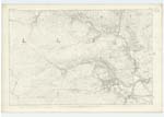
015 | [Situation] About 3/4 miles W. [West] by North of Clenrie. A large hill on the farm of Clenrie (hence the name) It is a conspicuous part of a range. - the Surface of which is rocky heathy pasture; On its Summit is a Trigl. [Trigonometrical] Station called by Trigl. [Trigonometrical] Party "Clenry" |
| GARROCH BURN | Garroch Burn Garroch Burn Garroch Burn |
William Folds John Murray Ainslies Map 1820 |
015 | [Situation] Running in an E. by N. [East by North] direction for about 3/4 mile, it then changes its course to N.E. by E. [North East by East] past the E. [East] Side of Clenrie farm house where it is joined by the Black Burn A Considerable stream or Burn taking its rise on the farm of Clenrie and running in an Easterly direction to its confluence with the Water of Ken. From its junction with Glenlee Burn it is called Coom Burn to its influx with Ken. |
Continued entries/extra info
[Page] 3Parish of Kells
Form 136
Page 19 - Rig of Clenrie
19 - Garroch Burn
Transcribers who have contributed to this page.
Chr1smac -Moderator, Moira L- Moderator
Location information for this page.
Linked mapsheets.