OS1/20/35/16


| List of names as written | Various modes of spelling | Authorities for spelling | Situation | Description remarks |
|---|---|---|---|---|
| BENBRACK | BenbracK BenbracK Banbrack |
John Barbour William Arthur Ainslies Map 1820 |
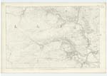
015 | [Situation] About 1 1/4 mile S. [South] of Clenrie. A large hill on the farms of Drumbuie Garrary & [Craigenbay] & is a conspicuous, part of [a] the surface of which consists [of] rocky heathy pasture On [its summit] is is a Trigl, [Trigonometrical] station called [by] Trigl, [Trigonometrical] Party "BenbracK". |
| BENBRACK BURN | Benbrack Burn Benbrack Burn Banbrack |
John Barbour William Arthur Ainslies Map 1820 |
015 | [Situation] Running in an E.S.E [East South East] direction till its junction with Glenlee Burn about 1 1/8 miles SE [South East] of Clenrie (farm house) A Small Stream taking its [rise ] at the West side of Benbrack & on the farm of Drumbuie [and] running in N. [North] Westerly direction to its conflux with Lochspraig |
Continued entries/extra info
[Page] 16Parish of Kells
Form 136
Page 32- Benbrack
32 - Benbrack Burn
Transcribers who have contributed to this page.
Chr1smac -Moderator, Moira L- Moderator
Location information for this page.
Linked mapsheets.