OS1/20/34/35


| List of names as written | Various modes of spelling | Authorities for spelling | Situation | Description remarks |
|---|---|---|---|---|
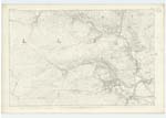
| EARLSTON LINN | Earlston Linn Earlston Linn Earlston Linn Earlston Earlstoun Earlston Linn |
William Duff John Brown John McCaul s.n. Dalry Val: [Valuation] Roll (modern) Val: [Valuation] Roll (Ancient) Ainslies Map 1820 |
015 | [Situation] About 5/8 mile W by N [West by North] of Earlston Castle. A Cascade of about 8 feet on the Water of Ken, up which the Salmom, except in high floods Cannot ascend & they here often excite observation by repeated and exhausting, though vain leaps to surmount the Water Spouts which repel their further progress, and large numbers falling an easy prey to fishermen with bug-nets. The Water for a considerable distance down runs in a very deep & narrow channel, and is embosomed on each Side by very precipitous rocks. It is on the land of Earlston and Situate a little to the West of the Castle hence the name. - |
Continued entries/extra info
[Page] 35 -- Parish of DalryTranscribers who have contributed to this page.
Chr1smac -Moderator, IanMcC
Location information for this page.
Linked mapsheets.