OS1/20/26/18


| List of names as written | Various modes of spelling | Authorities for spelling | Situation | Description remarks |
|---|---|---|---|---|
| SCARS OF BENYELLARY | Scars of Benyellary Scars of Benyellary |
Robert Wilson John Lambie |
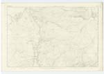
013 | [Situation] 3/4 Mile South of Black Gutter A high rocky precipice situated on the east side of "Benyellary " (hence the name) And farm of Stroan to ascend it would be quite impracticable with the exception [of] a Small portion near to the [Source] of "Gloon Burn" |
| BUCHAN BURN | Buchan Burn Buchan Burn Whiteland Burn |
Robert Wilson John Lambie Ainslies Map |
013 | [Situation] Running in a Southerly direction and falling into Loch Truil - A tolerably sized mountain stream gathering at the Eastern part of the "Merrick " on the farm of Stroan flowing in a southerly direction [flowing] into "Loch Truil" it once formed the boundary between the farms of Buchan & Stroan, from the former it derives [its name] |
Continued entries/extra info
Parish of Minnigaff - [Page] 18Form 136
Page 44 - Scars of Benyellary -
44- Buchan Burn
Scars. A bare place on the side of a
steep hill from which the sward has been washed
down by rain. Also a cliff
a ridge . Scott. Dicty [Scottish Dictionary]
Transcribers who have contributed to this page.
Chr1smac -Moderator
Location information for this page.
Linked mapsheets.