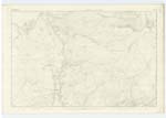
OS1/20/26/11


| List of names as written | Various modes of spelling | Authorities for spelling | Situation | Description remarks |
|---|---|---|---|---|
| KIRRIEMORE HILL | Kirriemore Hill Kirriemore Hill Kirriemore Hill Kirrymuir Kirriemuir Hill |
Robert McMillan Robert Wilson James McMillan Ainslies Map 1820 See Name Book 13A |
013 | [Situation] About 1 1/8 mile West of Black Gutter A tolerably sized rocky hill on the farm of "Kirriemore" (hence the name) This hill is the lowest of a range of hills diverging from the "Merrick" westwards towards the "Water of Minnick" On its Summit is a Trigl ◬ [Trigonometrical Station] called by Trigl. [Trigonometrical] Party "Cattymore Int"[Intermediate] |
| MULLACHGENY BURN | Mullachgeny Burn Mullachgeny Burn Mullachgeny Burn Mullachgeny Burn Mulhageny Burn Mulhageny Burn Mulhageny Burn Mulhageny Burn |
John Hyslop Robert McMillan John Murray James McGeoch Robert McMillan James McMillan William McMillan SeeName Book of Plan 13 A. |
013 | [Situation] Running in a Westerly direction to its Junction with KirKennan Burn A Small stream rising on the "Braes of Mulhageny" (hence the name) and flowing in a N. [North] Westerly And Westerly direction to its influx into "KirKennan" (in ruins) . |
Continued entries/extra info
Parish of Minnigaff - [page] 11Form 136
Page 35- Kirriemore Hill
35- Mulhageny Hill
Transcribers who have contributed to this page.
Chr1smac -Moderator
Location information for this page.
Linked mapsheets.