OS1/20/26/10


| List of names as written | Various modes of spelling | Authorities for spelling | Situation | Description remarks |
|---|---|---|---|---|
| KIRRIEREOCH HILL | Kirriereoch Hill Kirriereoch Hill Kirriereoch Hill Carroch Hill Kirerroch Kierroch |
Robert McMillan Alexander McSkimming William McMillan Ainslies Map 1820 Valn. [Valuation] roll 1819 Valn. [Valuation] roll Anct. [Ancient] |
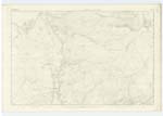
013 | [Situation] Near to the N. [North] Side of Merrick A rocky Mountain almost as [high] as "Merrick" and divided from [it by] a considerable portion of flat land called the "Fang of the Merrick" description) It is situated on the [farm] of "Kirriereoch" And Tarfessoch" farm [Ayrshire] extending east and west The boundary between the shire of Ayr and Kirkcudbright passes its summit on which is a Trigl. ◬ [Trigonometrical Station] called by Trigl. [Trignometrical] Party "Merrick Cont. Pt. " and from which a Commanding [view] can be obtained of part of the Counties of [Ayr] Wigtown and Kirkcudbright West Highlands, [Ailsa] Craig, Morne Mountains (in Ireland) And the [Isle] of Man. |
Continued entries/extra info
Parish of Minnigaff - [page] 10Form 136
Page 28- Kirriereoch Hill
Note Kirriereoch is the
Spelling recommended
by John McMillan Esqr.
Factor for Lord Galloway
Transcribers who have contributed to this page.
Chr1smac -Moderator
Location information for this page.
Linked mapsheets.