OS1/20/22/11


| List of names as written | Various modes of spelling | Authorities for spelling | Situation | Description remarks |
|---|---|---|---|---|
| CASTLEFERN WATER | Castlefern Water Castlefern Water Castlefern Water |
John McLellan William Grierson Dr Scott Craigmuir |
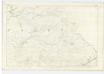
010 | [Situation] Running in a S E [South East] direction forming part of the N.E. [North East] boundary of the parish of Dalry. A considerable stream or burn having its rise on the farms of Knocksting and Troston, and running in a S. [South] Easterly direction (forming a boundary line betwixt the Counties of Dumfries and Kirkcudbrightshire) to its junction with two other burns near Minnyhive thence it is called "Cairn Water". |
| MINNYHIVE TRUST | Minnyhive Trust | List of Trust Roads | 010 | [Situation] Leading through part of the S W. [South West] side of the parish of Dalry passing Holmhead Bridge. This Trust extends from Knocklee to Castlefern near Minnyhive |
| POINTFOOT HILL | Pointfoot Hill Pointfoot Hill |
William Grierson Robert Charteris | 010 | [Situation] About 1/8 mile N. [North] East of Knocksting Loch A hill on the farm of Pointfoot the surface of which is Rocky and Heathy pasture |
Continued entries/extra info
[Page] 11Parish of Dalry
Left hand side of page [Form 136 Page 31 Castelfern Water; 43 Pointfoot Hill]
Transcribers who have contributed to this page.
Gerald Cummins
Location information for this page.
Linked mapsheets.