OS1/20/16/19


| List of names as written | Various modes of spelling | Authorities for spelling | Situation | Description remarks |
|---|---|---|---|---|
| ACQUAINTANCE HILL | Acquaintance Hill Acquaintance Hill |
Robert McAdam Thomas Crosby |
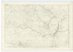
009 | An Eminence on the farm of Castlemaddy, its surface is rocky heathy pasture. On it is a Trigl. [Trigonometrical] Station called by Trigl. [Trigonometrical] Party "Sheil Craig". |
| DEIL'S DIKE | 009 | |||
| PULMADDY BURN | Pulmaddy Burn Pulmaddy Burn Polmaddy Burn |
Robert McAdam Ivy McCutcheon Ainslies Map. See Name List Plan 9 D |
009 | A considerable stream or burn having its rise between Corserine and Carlin's Cairn, and running in a S. [South] Easterly direction (bounding in its course divers farms passing through Pulmaddy (in ruins) (hence the name) to its confluence with the "Water of Deugh" near to Strangassel Toll Bar. During this Burn's whole length it forms a boundary line betwixt the parishes of Carsphairn and Kells. |
Continued entries/extra info
[Page] 19Parish of Carsphairn
Left hand side of page [Form 136 Page 59 Acquaintance Hill; 60 Pulmaddy Burn]
Acquaintance Hill
[Situation] 1 7/8 Miles W. [West] of Braidenoch farm house
Pulmaddy Burn
[Situation] Running in a S.E. [South Easterly] direction &. passing the South side of Drumness.
Transcriber's notes
DEIL'S DIKE - not on this pageTranscribers who have contributed to this page.
Gerald Cummins
Location information for this page.
Linked mapsheets.