OS1/20/156/3


| List of names as written | Various modes of spelling | Authorities for spelling | Situation | Description remarks |
|---|---|---|---|---|
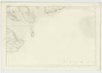
| ROUGH ISLAND | Henry Cumming Dr Mc Minn Ainslies Map 1820 |
052 | An island having about 25 acres of land, its surface consists of arable land and rocky heathy pastures, on it is an Trig Station. It is situated near the mouth of Urr Water in the Solway Frith and is wholly surrounded by water at ½ tides. | |
| SPRING STONES | James Sloan James Maxwell |
052 | A few detached rocks at the South end of Rough Island and near to low water mark. They are quite visible at low Spring tides and are very dangerous to coasting vessels, | |
| URR WATER | 052 | For description see Name List for plan 46 A. |
Transcribers who have contributed to this page.
cpm, haggis
Location information for this page.
Linked mapsheets.