OS1/20/151/71


| List of names as written | Various modes of spelling | Authorities for spelling | Situation | Description remarks |
|---|---|---|---|---|
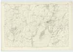
| FORT [Balig] | Fort Fort The Doon . The Doon . Camp . British Camp or Fort British Camp or Fort British Camp or Fort |
John Muir Mr Rigg John Brown Kirkcudbright Alexander McKennel Kirkcudbright Ainslies Map 1820 . Mr Bell . Mr McMinn . Mr Carnochan |
050 | [Situation] About 3/8 Miles S.E. [South East] of the town of Kirkcudbright. A considerable British Fort on the farm of Balig and Situated on the Summit of "Doon Hill", from it very probably the hill derived its name. The fort is of a Circular Shape and is surrounded by a double rampart or trench, which is very much defaced by the plough. - |
| RING BURN | Ring Burn Ring Burn Ring Burn Ringburn |
William Cornochan Thomas McMinn Map of County Stat. Acct. [Statistical Account] 1845 |
050 | [Situation] Running in a S. [South] Direction passing the W. [West] side of Doon Hill. A Small Street or burn taking its rise on the lands of Bombie and running in a Southerly direction to its conflux with the Solway Firth. It receives this name at Ring Bridge & retains it to a Mill Dam a little North of Dunrod and thence it is called Dunrod Burn to its influx with the Sea. - |
Continued entries/extra info
[Page] 71Parish of Kirkcudbright
Transcribers who have contributed to this page.
Chr1smac -Moderator, Skinnb1- Moderator
Location information for this page.
Linked mapsheets.