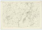
OS1/20/151/3
| List of names as written | Various modes of spelling | Authorities for spelling | Situation | Description remarks |
|---|---|---|---|---|
| HIGH NEWTON | High Newton High Newton Upper Newtoun Newtoun High Newton |
John Nichol Mathew Arbuckle Val [Valuation] Roll (1819) Valuation Roll (Anct) [Ancient] Ainslie's Map revd [revised] 1820 |
050 | [Situation] 1 1/8 miles W by N [West by North] of Kirkcudbright. A house and out houses all slated an in good repair. It had formerly a farm of land attached (the property of the Earl of Selkirk) but now blended with the farm of Compston End. - |
| NEWTON HILL | Newton Hill Newton Hill |
John Nichol Mathew Arbuckle |
050 | [Situation] 1 1/4 miles W by N [West by North] of Kirkcudbright. A considerable hill on the farm of High Newton, the soil of which is chiefly arable land. - |
| LOCHINGORE | Lochingore Lochingore |
John Nichol John Neil |
050 | [Situation] About 1 mile W by N [West by North of Kirkcudbright. A small sheet of water on the farm of Bishopton, situated a little to the South of Newton, possibly this name may Signify the Short Loch - Lochingare. |
Continued entries/extra info
[Page] 3Parish of Twyneholm
Form 136
Page 140 - High Newton
Page 140 - Newton Hill
Page 142 - Lochingore
Lochingore seemingly a corruption
of the Gaelic Loch nanghabhar ie the Goat, Loch
or Lochan gabhair The small Loch of the Goat.
Transcribers who have contributed to this page.
Chr1smac -Moderator, Skinnb1- Moderator
Location information for this page.
Linked mapsheets.


