OS1/20/14/5


| List of names as written | Various modes of spelling | Authorities for spelling | Situation | Description remarks |
|---|---|---|---|---|
| GARRYHORN BURN | Garryhorn Burn Garryhorn Burn Garryhorn Burn |
William Summerville William Lorimer Ainslies Map. 1820 |
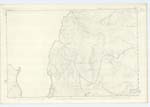
008 | [Situation] Rising near the N.W. [North West] base of Cairnsgarroch & running in a N.E. [North East] direction A small Stream or burn having its rise on the farm of Garryhorn (hence the name) and running in a Northeasterly to its confluence with the "Water of Deugh". |
| BLACK CRAIG | Black Craig Black Craig |
William Summerville William Lorimer | 008 | [Situation] 2 Miles E [East] of Loch Head farm house A portion of large tumbling rocks on the farm of Garryhorn. and situated on the Northern end of Cairnsgarroch, |
| ROYS | Roys Roys |
William Summerville William Lorimer | 008 | [Situation] 1 5/8 Miles E by S. [East by South] of Loch Head farm house A considerable extent of tumbling rocks on the farm of Garryhorn and situated on "Cairnsgarroch" hill. |
Continued entries/extra info
[Page] 5Parish of Carsphairn
Form 136 Page
21 Garryhorn Burn
22 Black Craig
21 Roys
Garryhorn Burn - Garryhorn from the Gaelic "Garbh chairn" The coarse rocky place
Transcribers who have contributed to this page.
DANIALSAN, Gerald Cummins
Location information for this page.
Linked mapsheets.