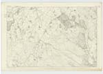
OS1/20/134/13


| List of names as written | Various modes of spelling | Authorities for spelling | Situation | Description remarks |
|---|---|---|---|---|
| BROWNIE HILLS | Brownie Hills Brownie Hills Browny Hills |
Thomas Hysop Map in posen [possession] of W. Lidderdale Esq. dated 1803 Valuation Roll 1819 |
045 | [Situation] About 1/2 mile SW [South West] of Gelston Castle. A number of small rocky Hills upon the Farm of Ingliston. |
| KIRKLAND OF GELSTON | Kirkland of Gelston Kirkland of Gelston Kirkland Kirkland of Gelston |
William Lidderdale Esq. Thomas Hyslop Ainslies Map 1797 Valuation Roll 1819 Appendix |
045 | [Situation] 5/8 mle S by E [South by East] of Gelston Castle. A small Farm with office houses all of which are in good repair attached is a farm of about 45 acres of land. It is the property of Charlses Kiran Esq. of Calson Park County Mayo Ireland. |
| GELSTON KIRK (Site of) | Gelston Kirk Gelston Kirk |
Thomas Hyslop Ainslies Map 1797 |
045 | [Situation] At the South Side of the farm steading of Kirkland of Gelston. This appears to have been the Parish Church of Gelston but now Gelston is annexed to Kelton together with Kirkcowrmack, at present there is nothing to be seen of the ruins but a small ridge denoting where the foundation walls stood, it is Situated in Gelston Kirkyard & immediately in rear of the office house belonging to the far-off Kirklds of Gelston. |
Continued entries/extra info
[Note under Gelston Kirk] This is Anglo Saxon means the residence of a person named Gall or GillTranscribers who have contributed to this page.
IanMcC
Location information for this page.
Linked mapsheets.