OS1/20/127/24


| List of names as written | Various modes of spelling | Authorities for spelling | Situation | Description remarks |
|---|---|---|---|---|
| THE ACRE | The Acre The Acremullan Smithy |
Charles Watt John Dixon |
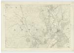
043 | [Situation] About 1/2 mile SE by S.[South East by South] of Kirkbride. A narrow belt of Plantation Situated along the West [bank] of Skyre Burn, and extending from Lagganmullan Smithy [to] Damhead, its wood chiefly Consists of Oak & Ash. |
| MILL MARK HILL | Mill Mark Hill Mill Mark Hill |
Charles Watt John Dixon |
043 | [Situation] About 15 Chains East of Kirkbride. A Small hill on the farm of Mill Mark (hence the name) its Surface Consists of rocky heathy pasture. |
| KIRKBRIDE | Kirkbride Kirkbride Kirkbride |
Charles Watt John Dixon Valn.[Valuation] Roll 1819 |
043 | [Situation] In the Southern Side of the parish of Anwoth near the E. [East] Side of Skyre Burn 24 Chains N.N.W. [North North West] from Kirkbride Bridge (County) A farm houses and offices in [?] repair, with a Considerable [?] of land attached. Occupied by David Harper. The property of G.S.Murray Esqr. of Cally. |
Continued entries/extra info
[Page] 24 Parish of AnwothTranscriber's notes
Note: Kirkbride. Some of the right hand Description words are obscured.Transcribers who have contributed to this page.
IanMcC
Location information for this page.
Linked mapsheets.