OS1/14/82/6


| List of names as written | Various modes of spelling | Authorities for spelling | Situation | Description remarks |
|---|---|---|---|---|
| ATHROS (Ruins) | Athros (Ruins) Athros (Ruins) Athros (Ruins) Athros (Ruins) |
Estate Map Mr. Black Factor A. McFarlane Leytack Mr. Gibb, Gamekeeper |
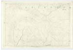
018 | The Ruins of an old hill farm dwelling on the East side of Trusty Burn. The name is, like those of the Ruins in the neighbourhood, well known and although long ago unoccupied they are land marks &c of the hills always used & referred to. |
| BETTYWHARRAN | Bettywharran Betty Wharran Hill and Athros Ridge Bedywharn |
Mr. Black Factor A. McFarlane Leytack Mr. Gibb, Gamekeeper Est. [Estate] Plan County Map |
018 | A long flat topped ridge following the course of the Trusty on its East side & terminating in the south with a Cairn on its point above the old places of Burnroot. Glenogil Estate Plan applies the name "Betty Wharran Hill" to the point above Burnroot & " Athros Ridge" to the ridge itself above the Athros. The name is applied, as adopted on Trace, in the whole locality |
Continued entries/extra info
[Page] 6Co. [County] Forfar -- Tannadice Parish
Transcribers who have contributed to this page.
Alison James- Moderator, KBMW- Moderator
Location information for this page.
Linked mapsheets.