OS1/14/60/37


| List of names as written | Various modes of spelling | Authorities for spelling | Situation | Description remarks |
|---|---|---|---|---|
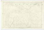
| OUTMOST GRAIN | Outmost Grain Outmost Grain North Grain |
William Hunter Waterhead Alexander Stewart Blackhaugh Property Plan |
018 | A small stream falling into "Burn of Corscarie". |
| DOG HILLOCK | Dog Hillock Dog Hillock Dog Hillock |
Ainslie's Co. [County] Map Property Plan William Hunter Waterhead |
018 | A small knoll on which the parishes of Lethnot, Cortachy, and Tannadice conjoin. |
| HILL OF GLANSIE | Hill of Glansie Hill of Glansie Hill of Glansie |
Property Plan William Hunter Waterhead Alexander Stewart Blackhaugh |
018 | A prominent and high feature at the head of "Burn of Glansie". |
| BURN OF GLANSIE | Burn of Glansie | Property Plan William Hunter Waterhead Alexander Stewart Blackhaugh |
018 | A good stream rising off "Hill of Glansie" and falling into Burn of Corscarie" a mile above "Waterhead." |
| MOUNT SNED | Mount Sned Mount Sned |
Property Plan William Hunter Waterhead Alexander Stewart Blackhaugh County Map |
018 | A high and prominent hill on the boundary between Tannadice and Lethnot |
Continued entries/extra info
[Page] 37Co. [County] Forfar
North Grain [note]
Is not North Grain another name for Outmost Grain?
see also p. [page] 32
Transcribers who have contributed to this page.
Alison James- Moderator, KBMW- Moderator
Location information for this page.
Linked mapsheets.