OS1/14/10/69


| List of names as written | Various modes of spelling | Authorities for spelling | Situation | Description remarks |
|---|---|---|---|---|
| GAA SAND HILL | Gaa Sand Hill Gaa Sand Hill Gaa Sand Hill Gaa Sand Hill Buddon Ness Sand Hill |
Chart of the Frith of Tay by Robert Stevenson C.E. [Civil Engineer] 1816 Admiralty Chart of Frith of Tay by Commander Slater 1835 Mr. Jack, Harbour Master, Dundee Mr. Waugh, Factor to Lord Panmure James Martin, Lighthouse Keeper |
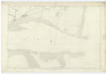
055 | [Situation] In the southern portion of Barry parish near the sea shore A sand hill 105 feet high, situated on the eastern coast of Barry Parish. It is a conspicuous and well known object. There is a tradition, that after the defeat of the danes by Malcolm II, many of their vessels on the way home foundered here, and that the sands accumulating over the wrecks through time formed this hill. |
| SANDY DOWNS | Sandy Downs Sandy Downs Sandy Downs Sandy Downs |
Chart of the Frith of Tay by Robert Stevenson C.E. [Civil Engineer] 1816 Admiralty Chart of Frith of Tay by Commander Slater 1835 Mr. Jack, Harbour Master, Dundee Mr. Waugh, Factor to Lord Panmure |
055 | [Situation] In the southern end of Barry parish adjoining the sea shore A large space of rough sandy ground, of which the Gaa Sand Hill forms the centre, situated close to the NE [North East] corner of Barry Parish. The name, as given here, is not generally known among the people of the parish, but I find it marked on the several charts, and the Harbour master at Dundee and Mr. Waugh, Factor, are familiar with the name. |
Continued entries/extra info
[Page] 69Barry Parish -- Sheet 55 plan 8 trace 1.
Transcribers who have contributed to this page.
Alison James- Moderator
Location information for this page.
Linked mapsheets.