OS1/14/10/68


| List of names as written | Various modes of spelling | Authorities for spelling | Situation | Description remarks |
|---|---|---|---|---|
| BARRY LINKS | Barry Links Links of Barry |
Admiralty Coast Chart 1835 Mr. Waugh, Factor to Lord Panmure Mr. Jack, Harbour master, Dundee Mr. Auchterlonie Poor rate Collector Alexander Crawfurd, Gamekeeper Johnson's Co [County] Map Nautical Survey of the Tay by Robert Stevenson C.E. [Civil Engineer] 1816. |
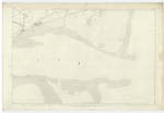
055 | [Situation] Consists of the Southern portion of Barry parish This name applies to all the lands in Barry parish situated south of the Railway, and which extend from Buddon Burn on the West to the High Water line on the east. A few years ago Barry Links were wholly rough pasture land, but lately small tracts have been reclaimed, and plantations formed. They are studded with mud houses, having each a few acres of land attached, feud to poor people. These houses Lord Panmure intends to have removed. Two lighthouses have been erected on these links, and on their eastern side is a large sand hill which is very conspicuous. The name "Barry Links" is extensively known, though often called "Links of Barry" |
| BARRY SANDS | Barry Sands Sands of Barry |
Admiralty Coast Chart 1835 Mr. Waugh, Factor to Lord Panmure Mr. Jack, Harbour master, Dundee Mr. Auchterlonie Poor rate Collector Nautical Survey of the Tay 1816. |
055 | [Situation] Along the southern side of Barry parish. This name applies to all the sands, between high and Low Water Mark, along the Barry Coast between Buddon Burn and Lochty Burn. A small portion of them at the S.E. [South East] corner of the parish is named the "Gaa Sand" |
Continued entries/extra info
[Page] 68Barry Parish -- Sheet 55 plan No. 7
Transcribers who have contributed to this page.
DANIALSAN, Alison James- Moderator
Location information for this page.
Linked mapsheets.