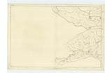
OS1/13/86/5


| List of names as written | Various modes of spelling | Authorities for spelling | Situation | Description remarks |
|---|---|---|---|---|
| SOUTH QUEICH | South Queich River South Queich River South Queich River South Queich South Queich South Quiech South Queich South Queich |
R.S. Moncrieff Esqr. Estate Maps Johnsons County Map Bells County Map Gazetteer of Scotland Chambers History of Scotland John Horne Esqr. See Plans 14B and 21D |
021 | [situation] Passing Earnyside farm ho. [House] and the Village of Carnbo. A small river rising on the Ochils near Innerdouny forming the West most boundary of Kinrosshire. its course through the Hills is both rugged & precipitous at Carnbo Village it bends Eastward and enters the Vale passes S. [South] of Kinross and soon enters Loch Leven. |
| OCHIL HILLS | Ochil Hills Ochil Hills Ochil Hills Ochil Hills |
Dr. [Doctor] Young Mr. James Anderson Mr. John Anderson See Name Book for Plan 14B |
021 | [situation] 1 Mile N. [North] of Carnbo. A bold range of mountains commencing in the vicinity of Stirling and extending E.N.E. [East North East] to the Firth of Tay an extent of 24 miles with an average breadth of 12. they form the N. [North] East boundary of the great mineral basin of Scotland |
Continued entries/extra info
5 Fossaway Parish Trace 1 21BParish of Fossaway: Fossaway: Parish of Fossaway} See Plan 30A [situation] In the Co. [County] of Kinross: For the Descriptive remarks of this parish see name book for Plan 30A
Transcribers who have contributed to this page.
MaxInSpain
Location information for this page.
Linked mapsheets.