OS1/13/77/27


| List of names as written | Various modes of spelling | Authorities for spelling | Situation | Description remarks |
|---|---|---|---|---|
| CARCRAIG | Carcraig Carcraig Carcraig Carcraig Carcraig Carcraig Carcraig Carcraig |
Fraser's Map of Fife Mr. James Blaik Aberdour Map of Parish of Aberdour Robert Beveridge Aberdour Mr. Smith Johnston's Co. [County] Map Mr. Kirkham Revd. [Reverend] H. Ralph L.L.D. [Doctor of Laws] |
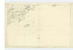
040 | [situation] 1/2 Mile N.E. [Northeast] of the Island of Inchcolm. A small island or rock situated about 1/2 mile east of Inchcolm, visible at the highest tides, there is a small quantity of grass growing on the rocks, which are very rugged and slope considerably from high to low water mark. |
Continued entries/extra info
27 Parish of Aberdour.Ph. [Parish] of Aberdour: Aberour: Ph. [Parish] of Aberdour: See Plan 36C [situation] Near the southern extremity of the Co. [County] of Fife. For descriptive remarks of this parish, see Name Book for Plan 36C.
[signed] John Bayly Capt. RE [Captain, Royal Engineers] 14 June 1854
Transcribers who have contributed to this page.
MaxInSpain
Location information for this page.
Linked mapsheets.