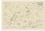
OS1/13/135/1/63


| List of names as written | Various modes of spelling | Authorities for spelling | Situation | Description remarks |
|---|---|---|---|---|
| LOW WATER LANDING SLIP [E of Burntisland] | Low Water Landing Slip | Harbour Map, Mr Jeffreys Kinghorn, Revd [Reverend] J Hardie |
036 | A half tide or low water landing Pier in the Firth of Forth, used at one time for Passage boats, but now not used for that purpose, since the Ferry Boats have been removed to Burnt island |
| PETTYCUR | Pettycur | Mr Davidson, Revd [Reverend] J Hardie, Mr Jeffreys, Harbour Map |
036 | A small village, composed of a few scattered houses, occupied by men engaged in fishing - coal trade & coke ovens etc. It has a small Harbour and Pier for vessels of small burden, there is also a half tide pier constructed for the use of ferry boats which plied here previous to the construction of the Railway. the coast between here and Burntisland is sandy, the sea has made great encroachment within these three hundred years, and still continues to gain ground. |
| PETTYCUR INN | Pettycur Inn | Mr Jeffreys, Revd [Reverend] Hardie, Mr Davidson, Sign Board |
036 | Portion of a well built large house used as an ordinary public house and occupied by J Nicoll. |
Continued entries/extra info
[Header]Plan 36D Kinghorn Parish 63
Transcribers who have contributed to this page.
RAAytoun
Location information for this page.
Linked mapsheets.