OS1/15/48/54


| List of names as written | Various modes of spelling | Authorities for spelling | Situation | Description remarks |
|---|---|---|---|---|
| BLACK LAW | Black Law | Mr William Brown, Halls John Wood Shepherd Halls Map of Halls farm |
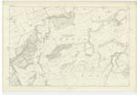
011 | A low Cultivated Hill on the farm of Halls, a Trigl. [Trigonometrical] Station is fixed on its highest point, the land is in the possession of Mr William Brown, and Mrs H N Ferguson of Beil is Owner. |
| WOODHALL BURN | Woodhall Burn | Mr William Brown, Halls John Wood Shepherd Halls Map of Halls farm |
011 | This stream takes the name "Woodhall Burn" from Tinkers leap, from which it runs in an N.E. [North East] direction through a ravine, the banks of which are Wooded until it joins Dry Burn a little North of Wallace's Mill. |
| STEEL CLEUGH | Steel Cleugh | Mr William Brown, Halls John Wood Shepherd Halls Map of Halls farm |
011 | A narrow deep ravine through which a Small stream runs which gathers on the South side of Black Law, and runs in a N [North] direction through this ravine until it reaches the Tinkers leap where it takes the name of Woodhall Burn |
Continued entries/extra info
[Page] 54Parish of Spott 11 D 3
Plan 11 D Trace 3
[Signed] James McAnulty
Transcribers who have contributed to this page.
DANIALSAN, JCB
Location information for this page.
Linked mapsheets.