OS1/15/15/26


| List of names as written | Various modes of spelling | Authorities for spelling | Situation | Description remarks |
|---|---|---|---|---|
| POWSHIEL | Powshiel Powshiel Powel Shiel Powel Shiel |
Thomas Dods William Shiel Johnston's Co. [County] Map Forrest's Co. [County] Map |
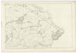
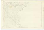
012 | [Situation] About 2 miles S.E. [South East] by E. [East] from Emmerscleugh. A small house one storey high occupied by a shepherd. |
| BROOM HILL | Broom Hill Broom Hill |
Thomas Dodds William Shiel |
012 | [Situation] About 2 miles E.S.E. [East South East] from Emmerscleugh. A small hill on the farm of Stolen cleugh. Its surface consists of arable land. It is part of the Lammermuir Hills. |
| THE BANK | The Bank The Bank Bank Bullions |
Thomas Dods William Shiel Forrest's Co. [County] Map |
012 ; 017 | [Situation] About 2 3/8 miles E.S. [East South] East from Emmerscleugh. A middling sized hill on the farm of Stolencleugh. Its surface consists of heathy pasture. On it is a Trigl [Trigonometrical] Station called "Crowscleugh". It is part of the Lammermuir Hills. |
Continued entries/extra info
[page] 26Parish of Oldhamstocks
38 - Powshiel
38 - Broom Hill
38 - The Bank
Transcribers who have contributed to this page.
Bizzy- Moderator, Jill S
Location information for this page.