OS1/15/15/25


| List of names as written | Various modes of spelling | Authorities for spelling | Situation | Description remarks |
|---|---|---|---|---|
| COCKLAW HILL | Cocklaw Hill Cocklaw Hill Cocklaw Hill Cocklaw Hill |
William Shiel Robert Chisholm Robert Purvis Johnston's Map |
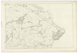
012 | [Situation] About 1 1/2 miles E [East] by S [South] from Emmerscleugh. A large hill a little S [South] east of BlacKcastle Hill. Its surface consists of heathy pasture. On it is a Trigl [Trigonometrical] Station called by Trigl [Trigonometrical] party "BlacKcastle". It is part of the Lammermuir Hills. |
| OLDHAMSTOCKS BURN | Oldhamstocks Burn Oldhamstocks Burn |
Thomas Dods William Shiel |
012 | [Situation] A little South of Easter Aikengall. A small stream or burn having its rise near Fairy Castle and running in a N [North] easterly direction to Douglas demesne where it changes its name to Douglas Burn. |
Continued entries/extra info
[page] 25Parish of Oldhamstocks
37 - Cocklaw Hill
43 - Oldhamstocks Burn
Transcribers who have contributed to this page.
Bizzy- Moderator, Jill S
Location information for this page.
Linked mapsheets.