OS1/15/8/10


| List of names as written | Various modes of spelling | Authorities for spelling | Situation | Description remarks |
|---|---|---|---|---|
| KEITH WATER | Keith Water Keith Water Keith Water |
Revd [Reverend] George Weir Humbie Manse Mr James Lamb Schoolmaster Revd [Reverend] John Henry Free Ch [Church] Manse |
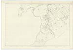
018 | [Situation] Runs in a Northeasterly direction, about 3/4 of a mile N.W. [North West] from Upper Keith A Considerable stream the Continuation of Costerton Water Eastwards to its junction with Humbie Water on 14D thence flows Northwards and falls into Birns Water, which falls into the Tyne, which falls into the Firth of Forth at Tynningham Bay. |
| KEITH WOODS | Keith Woods Keith Woods Keith Woods |
Revd [Reverend] George Weir Mr James Lamb Revd [Reverend] John Henry |
018 | [Situation] About 7/8 of a mile N.N.W. [North North West] from Upper Keith Several Woods, consisting of Mixed Forest & fir trees, on the "Keith Estate" along the the North side of "Keith Water and the West side of Humbie Water. The property of the Earl of Hopetown. They are chiefly on Plan 14D. |
| KEITH BRIDGE | Keith Bridge Keith Bridge Keith Bridge |
Revd [Reverend] George Weir Mr James Lamb Revd [Reverend] John Henry |
018 | [Situation] About 65 Chains N.W. by N. [North West by North] from Upper Keith. A good Stone Bridge of One Arch over the Keith Water on the Road from Upper Keith toward Ormiston. It is not a County Bridge |
Continued entries/extra info
[Page] 10Parish of Humbie
Plan 18 B
Transcribers who have contributed to this page.
DANIALSAN, elxosn
Location information for this page.
Linked mapsheets.