OS1/15/6/7


| List of names as written | Various modes of spelling | Authorities for spelling | Situation | Description remarks |
|---|---|---|---|---|
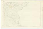
| LAMMERMUIR HILLS | Lammermuir Hills | See Name Book Plan 19B | 017 | [Situation] Extend through Centre and Southern portion of Ph. [Parish] of Innerwick. For Descriptive RemarKs See Name Book Plan 19B |
| PHILIP BURN | Philip Burn Philip Burn Philip Burn Philip Burn |
David Denholm James Johnston Johnston's Co. [County] Map Forrest's Co. [County] Map |
017 | [Situation] Forms Co. [County] Boundy. [Boundary] about 1⅛ miles South from Duddy Hill. A Small Stream which rises on Peat Law, flows in an easterly direction and falls into Monynut Water a short distance east of Bushelhill. |
Continued entries/extra info
[Page] 7Parish of Innerwick
Transcribers who have contributed to this page.
DANIALSAN, wilson5bh
Location information for this page.
Linked mapsheets.