OS1/9/14/69


| List of names as written | Various modes of spelling | Authorities for spelling | Situation | Description remarks |
|---|---|---|---|---|
| Site of the MILITARY WAY [New Kilpatrick] | Military Way (Parts of) Military Way (Parts of) Military Way (Parts of) Military Way (Parts of) Site of the Military Way |
Revd. Dr. [Reverend Doctor] Sym Minister of New Kilp. [Kilpatrick] Mr James Main, Windyhill Mr. John Freeman New Kilpatrick Mr. J. Wills, Ph. [Parish] Schoolmaster Caledonia Romana See Name Books of Cadder, and Cumbernauld Parishes |
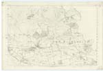
023 | "The Roman Wall consisted in the first place of an immense Fosse or Ditch - averaging about forty feet in width by some twenty in depth - which extended over hill & plain, in one unbroken line from sea to sea. Behind this Ditch, on its southern side & within a few feet of its edge, was raised a rampart of intermingled stone & earth, strengthened by sods of turf, which measured , it is supposed, about twenty feet in height & twenty four in thickness at the base. To the southward of the whole was situated the Military Way - a regular Causewayed road, about twenty feet wide - which kept by the course of the Wall at irregular distances, approaching in some places to within a few yards, & in others receding to a considerable distance." Caledonia Romana P. [Page] 278 & 279. From the eastern to the western Boundary of New Kilpatrick, by the course of the Wall - the Fosse, no clear remains of a Causeway are to be seen in those parts which have been pointed out & described by the personal authorities quoted as on the line of the Military Way. At some parts which will be afterwards noticed in succession from west to east, there is some roughness in the shape of stones partly above the surface, which may be considered as unusual in ordinary old roads. All the portions authorized as on the Military Way have been long ago converted into country roads, which is supposed to be the reason the people know so little about the Causewayed road to the south of the Wall. Almost the best proof to be traced now of the authorities quoted - the personal authorities, being correct for at least one of the parts adopted, is the local name - "Causeway", given to the road between Ledcameroch & the Fort of New Kilpatrick (23-15 & 16). This road passes through the Fort, to which all accounts both of the Fort & the Military Way agree. As stated by the Revd. Dr. [Reverend Doctor] Sym, the name "Causeway" in his young days - about 50 years ago, was well known, & he remembers seeing the Causeway tolerably distinct at places between the Fort & Ledcameroch. The other personal authorities quoted know the name "Causeway", as well as that it was the "Ancient" Road. Except the part just described, the actual extent to which the title of Military Way applies is generally very indefinite, and it has therefore been adopted only so far as the information obtained on the ground corresponds with the best Account seen - the Cal. [Caledonia] Romana compiled from the several writers on the subject. _ Beginning at the western Boundary of New Kilpatrick Parish, where the course of the great Ditch would cross over "Cleddin Burn" into O. [Old] Kilpatrick, an old Road between this & the Farm steading of N. [North] Hutcheson is, upon the authorities quoted on the line of the Military Way. How far east from the Burn (for this road would pass across the course of the Fosse at the Burn), the name should begin or the Causeway began in the present road is indefinite, but the Revd. Dr. [Reverend Doctor] Sym considers it to the "south of Hutcheson Hill" as the continuation of the "Causeway" from New Kilpatrick Fort by Ledcameroch, touching the north-west corner of "Garscadden Wood" This part was formerly the high road from Dumbarton to Glasgow. Between the points described the road is rough, with stones scattered through it, partly embedded in the ground, but there is nothing whatever of the regularity of the Causeway. The stones are generally of a round form - some of them almost as big as a man's head. This Road is not much used now. From the point where this old road joins the regular thoroughfare - the Ph. [Parish] road going north & south, to the south of N. [North] Hutcheson (23-15-2), no road or track is visible on the course the authorities describe, until coming to the north west corner of "Garscadden Wood". After crossing the Parish Road the continuation to the top corner of Garscadden [continued on page 70] |
Continued entries/extra info
[Page] 69Co. [County] Dumbarton & Stirling -- New Kilpatrick Parish
Transcribers who have contributed to this page.
Alison James- Moderator, Jim-B
Location information for this page.
Linked mapsheets.