OS1/9/14/20


| List of names as written | Various modes of spelling | Authorities for spelling | Situation | Description remarks |
|---|---|---|---|---|
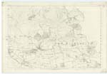
| MUGDOCK RESERVOIR (Continued) | Mugdock Reservoir (Continued | 023 | [continued from page 19] on Trace at the bottom of the bank, is the top or highest point to which the water rises when the Reservoir is full. The top or high water mark is all [ ] upon the authority of Mr. Moor, 5 feet below the level of the top of the bank, and according to the fall of the bank the more or less the horizontal width of the bank or slope; for example, the south side, running westwards from the Straining Tank has a fall of o[ne] foot in every 3 ft. [feet], making in all 15 feet = 23 [links] to the plumbed or vertical 5 feet of the high water mark below the top of the bank. The bank on the west is 4 to 1 = 30 links, being 7 links broader than the former - The descrip[tive] terms written on Exam. [Examination] Traces, such as "Shuttle" i.e. Sluice, "Stand Pipe" "Surface Clearing Shuttle", "Overflow Shuttle or Sluice" & "Straining Tank", are, as described by Mr. Moor. The Straining Tank is a circular well of 60 ft. [feet] in depth at the bottom of which are Pipes connected with the Sta[nd] Pipe on the one side & the Tunnel which measures 414 yards long down the Centre of the Road leading to Mil[ngavie] in direction of Glasgow. A cast metal coveri[ng] with moveable frames on the outside of the same mater[ial] stands a few feet above the surface or top of this Well. It has been shewn on Trace in a dark colour. A fine Viaduct, having 3 arches crosses the Reservoir near the Parish Boundary. There is a Shuttle or Sluice and a weir (which cant be shewn) at the viaduct. |
Continued entries/extra info
[Page] 20Co. [County] Sitrling & Dumbarton -- New Kilpatrick Parish
Transcribers who have contributed to this page.
Alison James- Moderator, eAndrew McEwan
Location information for this page.
Linked mapsheets.