OS1/9/10/32


| List of names as written | Various modes of spelling | Authorities for spelling | Situation | Description remarks |
|---|---|---|---|---|
| STATION (Remains of) [Roman fort, Bar Hill] | Barhill Fort (Remains of) Barhill Fort (Remains of) Barhill Fort (Remains of) Barhill Fort (Remains of) Barhill Fort (Remains of) Barhill Fort (Remains of) |
Caledonia Romana Fullarton's Gazetteer Captain Murray Gartshore Pr. [Proprietor] William Wallace Esqr of Auchinvole J Duncan Twechar John Cross Gartshore |
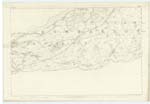
025 | This height (Barhill) rises in a somewhat conical form, to an elevation of, we should say, about five or six hundred feet, terminating in two separate peaks of which that to the south is somewhat the highest It is nearly equi-distant from the two extremities of the Isthmus, and is the loftiest ground traversed by the Wall. The view from its summit is very extensive, embracing to the south a wide extent of Country, & only bounded on the east & west by the glistening water of the two opposite Firths. It was probably from this point that Agricola looked around him, when he first became aware of the peculiar geographical character of the district which enabled him to extend a line of forts from sea to sea; & his troops may have been the first of the Romans who established their quarters on its wind-beaten summit. This the next Praetenturae stood of old on a level part of the height, about a furlong distant to the west of the northern or lowest of the two peaks. The Fort on Barhill was of a large size, and very strongly entrenched; measuring within the inclosure 340 feet square, and defended by a double circuit of Ramparts. (Note. Roy. Page 156, who states its distance from Auchindary at 3450 yards. Horsley says that it had been protected by treble envelopes on all sides but the north - Page 169). At one time the foundations of ancient buildings were exceedingly numerous here. Horsley observed several distinct lines of such ruins, and declares that when he visited it, the site of the Praetoreum was perfectly distinguishable. Many of these, indeed, have only been recently removed to supply materials for building, or to serve the purpose of inclosing the adjacent fields. The traces of the Barhill Station are still, however, to be faintly observed while the hollow of the great Ditch remains in excellent preservation near them. Unlike the Stations on the Wall, to the west, this stood detached from the Wall, and was situated a few yards to the south of its course. According to some Accounts the Military Way divided at this spot into two branches, one of them passing [continued on page 33] |
Continued entries/extra info
[Page] 32Co. [County] Dumbarton -- Kirkintilloch Parish
Transcriber's notes
Continued on page 33Transcribers who have contributed to this page.
Alison James- Moderator, douglas
Location information for this page.
Linked mapsheets.