OS1/10/54/35


| List of names as written | Various modes of spelling | Authorities for spelling | Situation | Description remarks |
|---|---|---|---|---|
| MILLGILL BURN | Millgill Burn Millgill Burn |
David Thomson William Thomson |
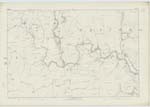
035 | [Situation] On the N.E. [North East] side of Enzieholm Height. A stream which rising in the East Side of Enzieholm Rig Height and running in a N.E. [North East] direction till it joins the River Esk at "Millgill Burn foot" |
| HARPERWHAT RIG | Harperwhat Rig Harperwhat Rig |
David Thomson William Thomson |
035 | [Situation] 1/2 mile N.E. [North East] from Bailiehill Height. An irregular shaped hill or Rig Situated between "Lyneholm Edge" and "Enzieholm Rig" Covered with rough pasture and belonging to the Farm of "Harperwhat" the property of the Duke of Buccleugh. |
Continued entries/extra info
[Page] 35Westerkirk Parish -- Sheet 35 N0. 15 Trace 3
Transcribers who have contributed to this page.
DANIALSAN, Larry mag
Location information for this page.
Linked mapsheets.