OS1/10/50/94


| List of names as written | Various modes of spelling | Authorities for spelling | Situation | Description remarks |
|---|---|---|---|---|
| FORT (Remains of) [Laverhay] | British Fort(site of) British Fort (site of) |
David Rogerson Leithenhall William Bell Leithenhall Thomas Kennedy Killbrook C Stewart Esq [Esquire] (Hillside) |
025 | Vestiges of a British Fort, situated on the farm of Leithenhall, the shape is that of an oval |
| LOWER BURN | Lower Burn Lower Burn Lower Burn |
David Rogerson Leithenhall William Bell Leithenhall Thomas Kennedy Killbrook |
025 | A small stream having its source a little to the north of Leithenflatt Pl[antation] and runs in a southerly direction, it joins Wamphray Water. |
Continued entries/extra info
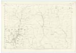
94 Parish of Wamphray Plan 25.9 Trace 5Lower Burn situation From the South West side of Bell's Knowe South to Wamphray Water.
British Fort situation 72 Chains South West by South from Laverhay
Philip MUnro Lance Corporal Royal Engineers
Transcribers who have contributed to this page.
stellas
Location information for this page.
Linked mapsheets.