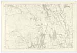
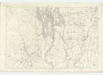
OS1/10/50/173
| List of names as written | Various modes of spelling | Authorities for spelling | Situation | Description remarks |
|---|---|---|---|---|
| GIRTHHEAD | Girthhead Girthhead Girthhead |
Estate Map Mr Rogerson Proprietor Alexander Rogerson Girthhead Fullartons Gazeteer of Scotland 2nd Volumn Page 795 Valuation Roll of County Dumfries |
033 | A farm with dwelling and office houses in good repair, dwelling house bears date 1700, situated near the River Annan and near the southern boundary of the Parish. |
| RIVER ANNAN | River Annan | Blackwoods County Map Johnstons County Map Parish Statistics J H Johnstone Esq [Esquire] Raehills Charles Stewart Esq [Esquire] Hillside Fullartons Gazeteer Websters Topographical Dictionary Blacks County Map |
024; 033 | Rises in the mountains above Moffat, and after running south for 37 miles through the valley of Annandale, it falls into the Solway Firth, about a mile below the town of Annan. River Annan is the correct name not Annan Water as named sometimes by the Plebians, besides it is a river. |
Continued entries/extra info
173 Parish of Wamphray Sheet 33.8 Trace 1River Annan situation On the Western Parish Boundary
Caledonian Railway
Mr Charters Parish Schoolmaster
David Rogerson Esq [Esquire] Leithenhall
Samuel Rogerson Esq [Esquire] Leithenhall
A line of railway betwixt Edinburgh and Carlisle.
Situation From Western boundary South through South West division of Parish
Girrthhead situation Near the South Western point of this Parish.
John Jane Sapper Royal Engineers
Transcribers who have contributed to this page.
stellas
Location information for this page.


