OS1/10/50/142


| List of names as written | Various modes of spelling | Authorities for spelling | Situation | Description remarks |
|---|---|---|---|---|
| HOWGILL FELL | Howgill Fell | Estate Map John Carruthers Kirkhill John Charters Parish Schoolmaster |
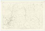
025 | A high hill of a ridge shape, situated on the farm of Kirkhill, and among the eastern range of hills, that run through the south of the parish. |
| WHITE MOSS | White Moss | EstateMap John Carruthers Kirkhill John Charters Parish Schoolmaster |
025 | This name is given to a narrow portion of wet mossy ground, that lies in a hass or hollow betwixt the Howgill Fell and Middle Rig. |
Continued entries/extra info
142 Parish of Wamphray Sheet 25.14 Trace 2Howgill Fell situation 32 Chains North North West from Criffel
Entry for Middle Rig scored out
White Moss situation At the East side of Howgill Fell
John Jane Sapper Royal Engineers
Transcribers who have contributed to this page.
stellas
Location information for this page.
Linked mapsheets.