OS1/10/50/132


| List of names as written | Various modes of spelling | Authorities for spelling | Situation | Description remarks |
|---|---|---|---|---|
| KIRKHILL | kirkhill Kirkhill Kirkhill |
Estate map John Carruthers Esq[Esquire] Rev[Reverend] George Wight Johnston's County Map Valuation Roll 1827 |
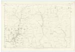
025 | A farm with superior dwelling and office houses including a good threshing machine, The building stands on high ground a little to the east of Parish Church. [There were Druidical circles on this farm at one time one of which stood in a field a little east from the farm steading, one on the Pinnacle hill and one on what is called Tath Knowes, these three have been removed, the fourth still remains (M D unnecessary)] |
Continued entries/extra info
132 Parish of Wamphray Sheet 25.13 Trace 3Kirkhill situation 1/4 mile South East from Parish Church
Leithenhall Bank See Page 98
John Jane Sapper Royal Engineers
Transcribers who have contributed to this page.
stellas
Location information for this page.
Linked mapsheets.