OS1/10/48/123


| List of names as written | Various modes of spelling | Authorities for spelling | Situation | Description remarks |
|---|---|---|---|---|
| GIMMENBIE BURN | Gimminbie Burn Gimminbie Burn Gimmonbie Burn Gimmenbie Burn |
Mr. William Farish, farmer Mr. James Bell, farmer Mr. Johnstone of Gibson See Page 117. |
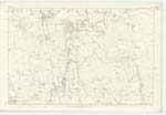
051 | [Situation] On Sn. [Southern] Parish Boundary. A short tiny brook, farmed from the gatherings of several, small head rills, on the North of Birrenswork-hill It runs in a S.W. [South West] direction, & falls into the Milk Water, for a considerable distance it forms the By. [Boundary] between Tundergarth & Hoddam Phs. [Parishes]. |
| DOOKERS POOL | Dookers Pool Dookers Pool Dookers Pool |
J. Jardine J. Murray J. Jamieson |
051 | [Situation] In Water of Milk A deep eddying pool in the Water of Milk. |
| KATIE'S POOL | Katey's Pool Katey's Pool Katie's Pool |
Mr. James Bell farmer, Mr. William Farish, farmer Mr. William Jardine farmer, |
051 | [Situation] In Water of Milk. A small, but deep pool in the Milk Water, the name is established from time immemorial. Katey, an abbreviare of the name Catharine. |
| GIMMENBIECLEUCH BRIDGE | Gimminbiecleugh Bridge Gimminbiecleugh Bridge Gimminbiecleugh Bridge |
Mr. James Bell (farmer) Mr. Johnstone of Gibson Mr. William Farish farmer |
051 | [Situation] Over Gimminbie Burn. A stone bridge of one arch, across Gimminbie Burn, on the Ph. [Parish] road leading through Tundergarth, & Hoddam. |
Continued entries/extra info
[Page] 123Parish of Tundergarth -- Plan 51.10
[Signed] M. Donohue
3rd. Febr. [February] 1857
Transcribers who have contributed to this page.
CorrieBuidhe- Moderator, Brenda Pollock
Location information for this page.
Linked mapsheets.