OS1/10/48/11


| List of names as written | Various modes of spelling | Authorities for spelling | Situation | Description remarks |
|---|---|---|---|---|
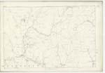
| DOD HILL | Dod Hill Dod Hill Dod Hill |
John Common (Farmer) Richard Common (Farmer) John Boyes (Shepherd) |
044 | [Situation] 65 chains N.W. [North West] from Ward Hill A Considerable hill near the east side of this Parish. |
| FRIAR EDGE | Friaredge Friaredge Friaredge Friar Edge |
John Common (Farmer) Richard Common (Farmer) John Boyes (Shepherd) Johnstone's County Map |
044 | [Situation] 1/2 mile N.W. [North West] by West from Ward Hill A Considerable hill a little to the south of Dod Hill the name has been established from time immemorial. |
| GLAISTER BURN | Glaister Burn Glaister Burn Glaister Burn |
John Common (Farmer) Richard Common (Farmer) John Boyes (Shepherd) |
044 | [Situation] 3/4 mile N.W. [North West] from Ward Hill A Rivulet which rises a little to the east of Dod Hill and falls into the Water of Milk. |
Continued entries/extra info
[Page] 11Parish of Tundergarth -- Plan 44.3 Trace 1
[Signed] Philip Munro
Lce Corpl R.E. [Lance Corporal Royal Engineers]
Transcribers who have contributed to this page.
CorrieBuidhe- Moderator, Brenda Pollock
Location information for this page.