OS1/10/47/87


| List of names as written | Various modes of spelling | Authorities for spelling | Situation | Description remarks |
|---|---|---|---|---|
| WATH BURN | Wath Burn Wath Burn Wath Burn Oxgang Burn Linns Burn Wath Burn Wath Burn |
William Manson Walter Bell Mrs Nicholson James Gibson James Gibson Gazetteer of Scotland Johnstone's Co. [County] Map |
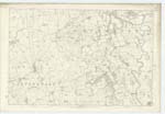
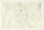
050; 056 | [Situation] Tracing En. [Eastern] Parish Boundary. A Small Stream, rises on the Farm of Cocketfield & flows in a Southerly direction forming the Boundary between the Parishes of Torthorwald & Mouswald to its confluence with Lochar Water. It generally receives the names of the different Farms through which it flows but I think Wath Burn is the most appropriate. |
| OXGANG | Oxgang Oxgang Oxgang |
James Gibson William Thomson William Manson |
056 | [Situation] Nearly 2 Miles S.S.E. [South South East] of Torthorwald. A Farm House with outbuildings & Farm of land attached the property of the Marqs. [Marquis] of Queensberry & occupied by William Thompson. This name is wrote on the adjoining Plan to an Old Building which was the first Farm house of that name which is now called Low Oxgang |
Continued entries/extra info
[Page] 87Parish of Torthorwald Plan 56.2 Trace 1
[Signed] John Stoddart
Lce. Corpl. RS&M [Lance Corporal Royal Sappers & Miners]
Transcribers who have contributed to this page.
DANIALSAN, lowlandscot
Location information for this page.