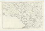
OS1/10/47/62
| List of names as written | Various modes of spelling | Authorities for spelling | Situation | Description remarks |
|---|---|---|---|---|
| LOCHAR WATER | Lochar Water Lochar Water Lochar Water |
Johnston County Map William Lithgow David Paterson |
049; 050; 056 | [Situation] Tracing Wn. [Western] Parish Boundary. A large stream flowing in a southerly direction through this Plan Bear this name from the Junction of Amisfield & Park Burns to the Solway. |
| ROUCAN MEADOWS | Roucan Meadows Roucan Meadows Roucan Meadows |
William Richardson James Potter William Little |
050 | [Situation] In Wn. [Western] vicinity of Roucan 3/4 mile S.W. [South West] of Torthorwald. A large portion of Lochar Moss affording good meadow and rough pasture. |
| TODHOLE POTS | Todhole Pots Todhole Pots Todhole Pots |
William Richardson James Potter William Little |
050 | [Situation] 1 1/4 Mile S.W. [South West] of Torthorwald Village. A deep hollow formerly a loch now drained and cultivated |
| LOCHAR BRIDGE | Lochar Bridge Lochar Bridge Lochar Bridge |
William Richardson James Potter William Little |
050 | [Situation] Upwards of a mile S.W. [South West] of Torthorwald village/ A county bridge across Lochar Water on the road from Dumfries to Lockerby the structure in Wood and Stone buttresses |
Continued entries/extra info
[Page] 62Parish of Torthorwald Plan 50/13 Trace 1
[Signed] Samuel Hill
Lce. Corpl. RS&M [Lance Corporal Royal Sappers & Miners]
Transcribers who have contributed to this page.
DANIALSAN, lowlandscot
Location information for this page.


