OS1/10/42/34


| List of names as written | Various modes of spelling | Authorities for spelling | Situation | Description remarks |
|---|---|---|---|---|
| CRAW BURN | Craw Burn Craw Burn Craw Burn |
William Sharpe Samuel sharpe Robert Dryfe |
012 | A small stream that h[as] iys rise near the North [of] this Parish and flows [in] a southwardly direction [where it] joins Pulgowan Cleuch. |
| POLGOWN | Pulgowan Pulgowan Pulgown Polgowen Polgown |
William Sharpe John Sharpe Robert Sharpe Johnston's County Map Duke of Buccleuch Rent Roll and Estate documents. |
012 | A farm house and stea[ding] and garden and sh[eep] farm - the property of the duke of Buccleuch [] farmed by Mr McT[] the house is occupied by William Dryfe |
Continued entries/extra info
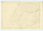
34Parish of Penpont
Plan 12/16
Trace 2
[Craw Burn, in the 'Situation' column reads] From Crawburn Head near NWn. [North Western] point of Parish S.S.E. [South South East] to Pulgowan Cleuch (Burn)
[Polgowan, in the 'Situation' column reads] About 9¾ miles N.W. [North West] from Penpont village.
[Signed]James Cowan
Transcriber's notes
Right hand side of page missing, some words estimated.There is also an entry for Pulgowan Hill on this [page, but crossed out. It reads:
Pulgowan Hill -- William Sharpe John Sharpe Robert Dryfe -- -- The sheep pasture land of the farm of Pulgow[an]
Transcribers who have contributed to this page.
John Dunlop
Location information for this page.
Linked mapsheets.