OS1/10/35/1


| List of names as written | Various modes of spelling | Authorities for spelling | Situation | Description remarks |
|---|---|---|---|---|
| LANGHOLM [parish] | Langholm Langholm Langholm |
Walkers' Map of Dumfriesshire Crawfords' Map of Dumfriesshire Johnston's Map of Dumfriesshire |
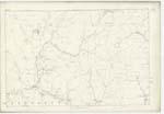
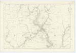
036; 044; 045; 052; 053 | [situation] In SEn. [South Eastern] division of Dumfriesshire. This Parish derives Name from the holm or flat lands which stretch along the banks of the River Esk, upon which it is situated. |
Continued entries/extra info
[page] 1Ph. [Parish] of Langholm Co. [County] of Dumfries
Note. "Langholm Parish" says Chalmers in his Caledonia "comprehends the ancient Parishes of Staplegarton Wauchope and half of Morton Parish. The district upon either bank of the Esk below Wauchope belonged to the Priory of Canonbie. It stood near the Old Castle of Wauchope. It was demolished after the union of the Parishes in 1703. About the beginning of the last Century the Parish of Morton in Annandale was suppressed and the half of it annexed to Wauchope, which annexation still continues by the name Half Morton. The other half was united to Canonbie. The Site or Remains of Morton or Sark Church occurs in Canonbie Ph. [Parish].
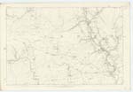
The Parish of Langholm is bounded on the North by those of Westerkirk and Ewes, on the East by Ewes and Canonbie, on the south by Canonbie and Half Morton, and on the West by Middlebie and Westerkirk. There is no detached part of Langholm within the boundaries of another Parish nor is there within the limits above assigned to it a detached portion of any other Parish. The quad civilia Parish of Half Morton is however united quoad sacra to that of Langholm. The greatest length of this Parish is 8 miles, its greatest breadth 61/4 miles and its entire Area has now been computed at 17,180 Impl. [Imperial] Acres, of which 2,793 acres may be arable, 600 wood, and 13,787 pasture, roads, water etc. All the arable land lies along the bank of the Esk and its tributaries and is sheltered by finely wooded slopes, beyond which stretch to the West, North-West and South-East verdant hills which in many instances gradually attain an altitude of about 1,000 feet. The principal Streams Tarras Water on the Eastern boundary, Ewes Water from Ewes Ph. [Parish] in the Nr. [Northern] district and Wauchope Water from the Wn. [Western] district all contribute their Waters in the district to the River Esk which from North to S.S.E. [South South East] nearly bisects this Parish. Numerous rills and springs occur throughout the district. The Turnpike Road from Edinburgh to Carlisle from West to East runs through the [continued on next page]
Transcribers who have contributed to this page.
CRIMSON
Location information for this page.
Linked mapsheets.