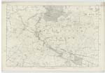
OS1/10/33/51


| List of names as written | Various modes of spelling | Authorities for spelling | Situation | Description remarks |
|---|---|---|---|---|
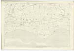
| KIRTLE WATER | Kirtle Water Kirtle Water Kirtle Water |
Fullartons' Imperial Gazetteer Johnstones County Map Blackwoods County Map |
052; 058; 063 | [situation] On the Wn. [Western] Parish Boundary. A considerable stream having its source on the estate of Kirtletown in the parish of Middlebie, it forms for a considerable distance the boundary of this parish with Middlebie, Annan & Dornoch & flows into the Solway Firth Kirtle derived from Kirkdel ie Church Valley there was Churches formerly on the banks of this Water |
| ALLERBECK | Allerbeck Allerbeck Allerbeck |
On Lease etc. John Maxwell Springkell James Rome Occupant |
058 | [situation] On the East bank of Kirtle Water. A farm house with offices attached all well built, slated & in excellent repair, their is a mill for grinding corn, which with the threshing mill is worked by water power. Allerbeck this is the mode approved by Sir John Maxwell Bart. [Baronet] of Springkell Proprietor Aller signifies the Alder. |
| HANGINGHIP PLANTATION | Hanginghip Plantation Hanginghip Plantation Hanginghip Plantation |
P.A.E.J. Smith Esq Langshaw James Rome Allerbeck Mr Leslie |
058 | [situation] On the East bank of Kirtle Water. A small plantation on the estate of Langshaw & at a curious bend in the Kirtle Water, it cheifly consists of Fir trees. |
Continued entries/extra info
[page 51]Parish of Kirkpatrick Fleming Plan 58.6 Trace 1
[note] Alderbeck Should be adopted [initialled] --D
[signed] Charles J Fearnside S.R.E. [Sapper Royal Engineers]
Transcribers who have contributed to this page.
CRIMSON
Location information for this page.