OS1/10/27/80


| List of names as written | Various modes of spelling | Authorities for spelling | Situation | Description remarks |
|---|---|---|---|---|
| CACRABANK HILL | Cacrabank Hill Cacrabank Hill Cacrabank Hill Cacrabank Hill |
Mr. Rogerson, farmer Fingland John Graham Esqr. Shaw Old Estate Maps See Wamphray Name Book |
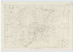
034 | [Situation] On the boundary between Wamphray and Hutton and Corrie. A hill feature of considerable altitude. |
| COTES BURN | Cotes Burn Cotes Burn Cotes Burn |
John Graham Esq. Estate Map Walter Brydon, Shepherd, Windshiels |
034 | [Situation] From 1/4 mile N.E. [North East] of Marygill Hill - S.S.E. [South South East] to Caulddel Burn. A small stream which rises at a short distance N. [North] East from Matthew's Hill, and runs into Cauld-del Burn. |
| MARYGILL BURN | Marygill Burn Marygill Burn Marygill Burn |
John Graham Esqr. Walter Brydon John Erseman, Shepherd of Shankend. |
034 | [Situation] From 31 chains N.W. [North West] from Windshiel Hill S. by E. [South by East] to Caulddel Burn. A small stream that rises at point about 1/2 a mile N. [North] West from Windshiel and runs into Cauld-del Burn at Marygill Foot. |
Continued entries/extra info
[Page] 80Hutton & Corrie -- Sheet 34.6 Trace 3
Cotes Burn [note] Cotes the name of an extinct Estate
[Signed] John Jane
Sapper R.E. [Royal Engineers]
Transcribers who have contributed to this page.
CorrieBuidhe- Moderator, norma
Location information for this page.
Linked mapsheets.