OS1/10/27/29


| List of names as written | Various modes of spelling | Authorities for spelling | Situation | Description remarks |
|---|---|---|---|---|
| RAMSHAW RIG | Ramshaw Rigg Ramshaw Rigg Ramshaw Rigg Ramshaw Rig |
Robert Graham McMaa Fold Andrew Reeive Finnygill Adam Laidlaw Finnygill Walter Carruthers, Mcmaw |
025 | [Situation] At the West side of Parish. An elevated ridge of land on Finnygill Farm |
| STONEY GILL | Stoneygill Burn Stoneygill Burn Stoneygill Burn Stoney Gill |
Robert Graham McMaa Andrew Reeive Finnygill Adam Laidlaw Finnygill Walter Carruthers, Mcmaw |
025 | [Situation] From the East of Laverhay Height S.E. [South East] to Dryfe Water. A stream rising on the S.E. [South East] side of Laverhay Hill runs through Finnygill & McMaa Farms & empties itself into Dryfe Water. |
Continued entries/extra info
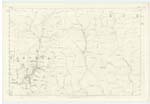
[Page] 29Parish of Hutton & Corrie -- Sheet 25.10 Trace 1
[Signed] John G. Andrew
S.R.E. [Sapper Royal Engineers]
Transcribers who have contributed to this page.
CorrieBuidhe- Moderator, norma
Location information for this page.
Linked mapsheets.