OS1/10/27/141


| List of names as written | Various modes of spelling | Authorities for spelling | Situation | Description remarks |
|---|---|---|---|---|
| HUTTON MOAT | Hutton Moat Hutton Moat Hutton Moat Moat |
Mr. J Graham Shaw Mr. Wright Boreland John Beatie Hutton Johnston's County Map |
034 | [Situation] About 3/4 mile West from Corse Hill. A large Moat on the farm of Hutton, it has a small entrenchment round it & is in very good preservation. A neat conical mount, formerly used as a beacon and Signal post. |
| HEWK BURN | Hewk Burn Hewk Burn Hewk Burn Heuk Hewk Burn |
Mr. C Stewart (Factor) Mr. J Graham Shaw James French Boreland Valuation Rolls Johnston's Map of Dumfriesshire. |
034; 043 | [Situation] From 33 chains West from Corse Hill - S.S.W. [South South West] to Dryfe Water. A small stream rising on the farm of Hutton & running through the Parish of Applegarth falls into Dryfe Water. |
Continued entries/extra info
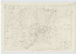
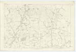
[Page] 141Parish of Hutton & Corrie -- Plan 34.15 Trace 4
[Signed] Charles J. Fearnside
S.R.E. [Sapper Royal Engineers]
Transcribers who have contributed to this page.
CorrieBuidhe- Moderator
Location information for this page.